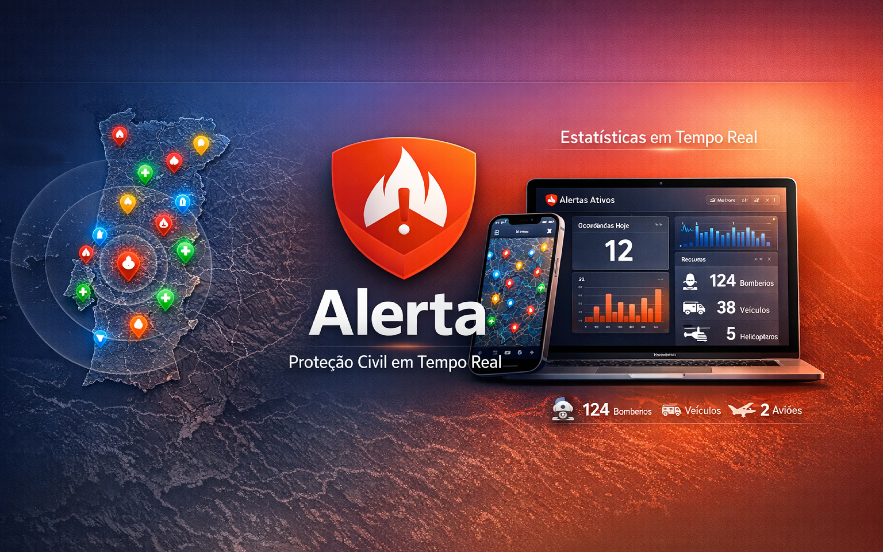

Inside the app
Real-time map, community reports, statistics, earthquakes and push alerts — all in one place.
Community Reports New
Spotted a fallen tree, a power outage or a blocked road? Report it in seconds and help your community. Sign in with Apple or Google, choose the incident type, attach a photo, and your report shows up on everyone's map.
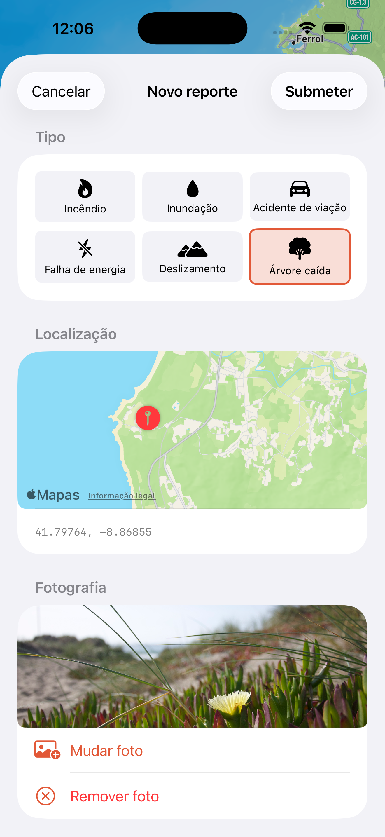
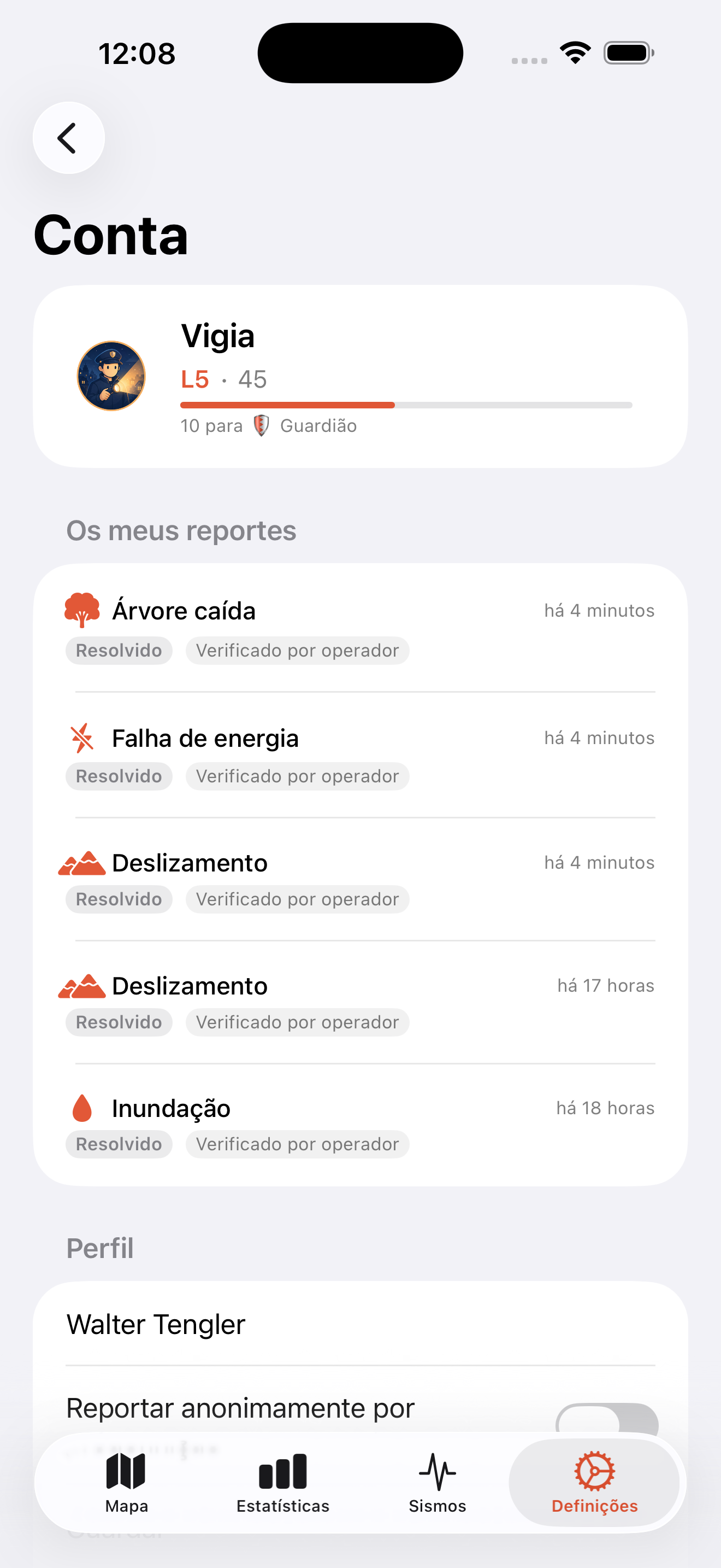
You can submit anonymously at any time, and reports are moderated by operators to keep the data trustworthy. Verified reports raise your trust score; invalid ones lower it.
Features
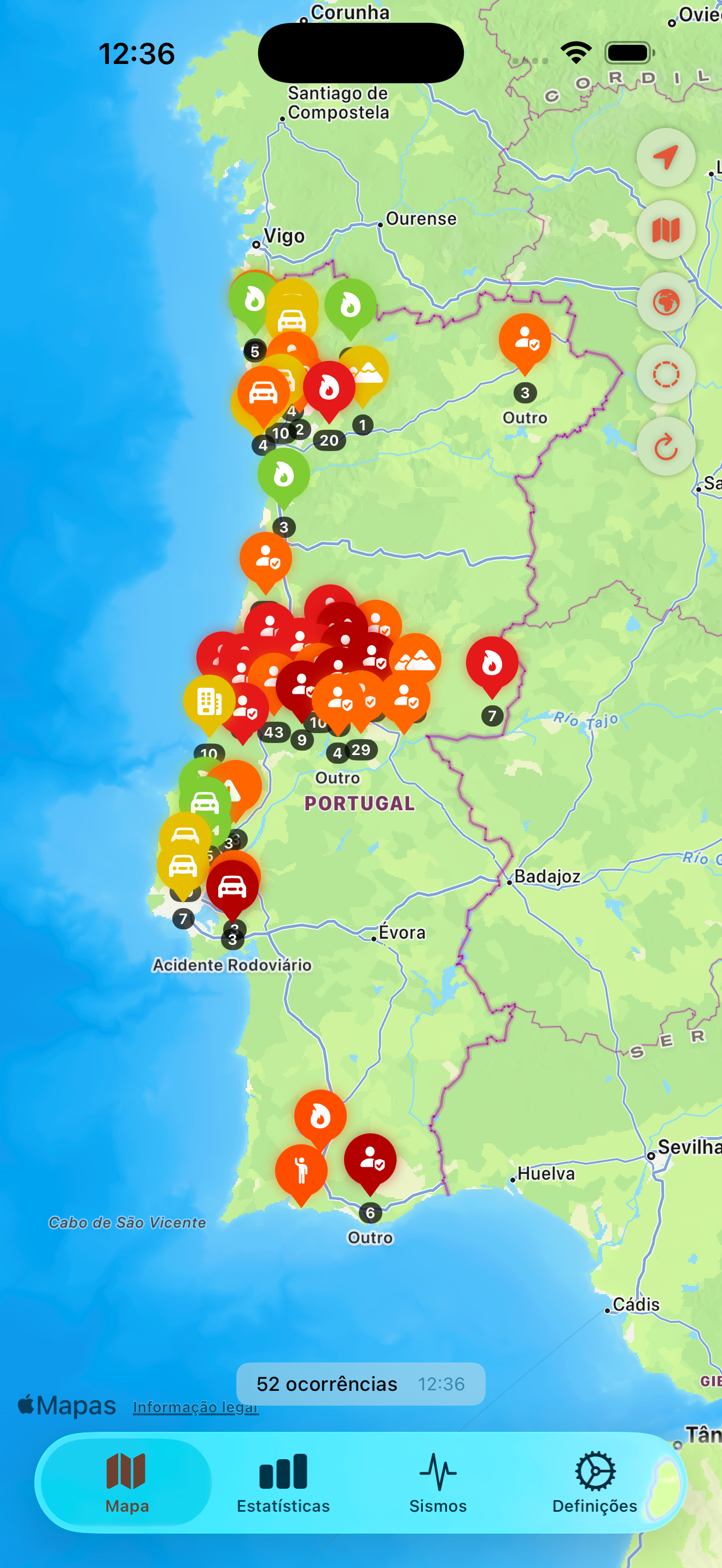
Interactive Map
See every incident on an interactive map. Filter by type and tap any marker to see the full detail.
Push Alerts
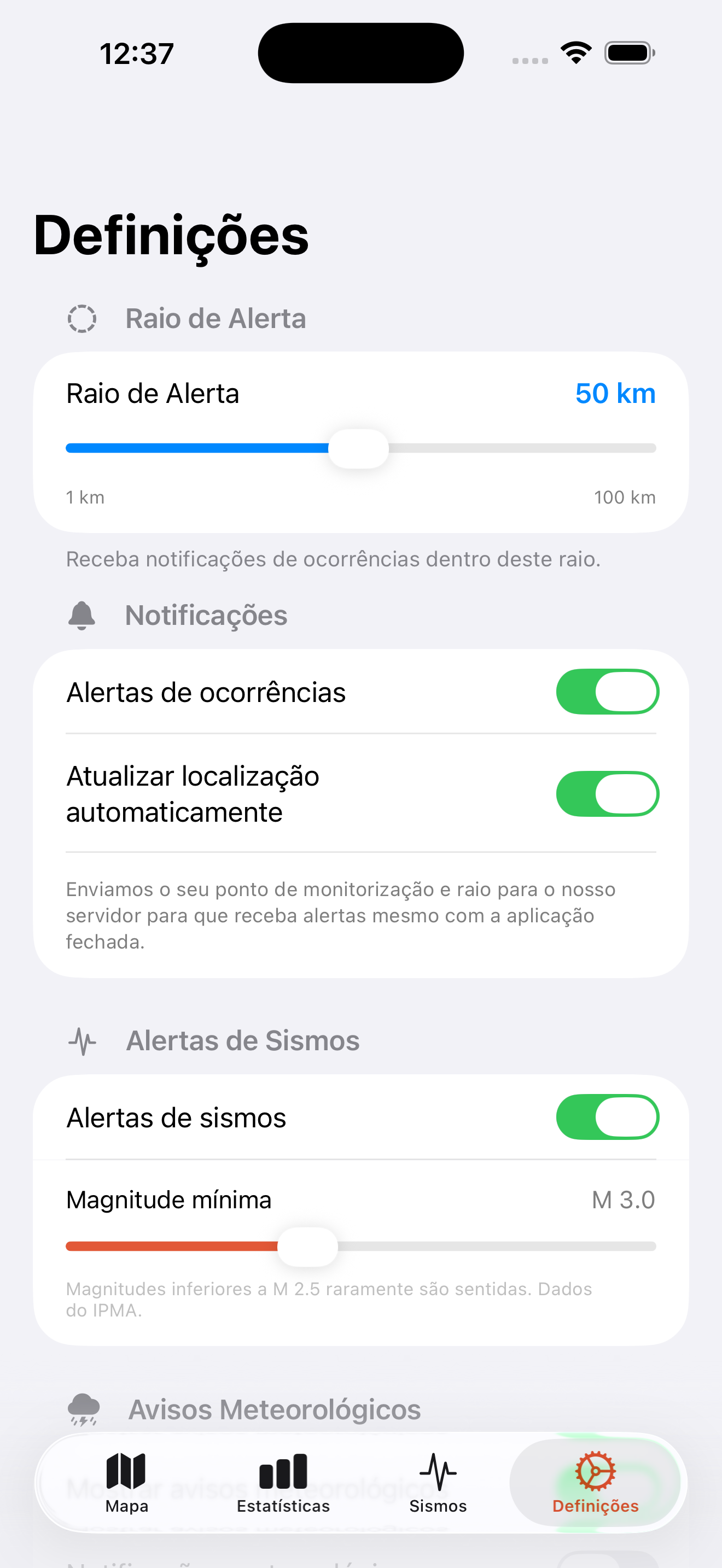
Get notified when new incidents appear nearby. Configure the alert radius to match your needs.
Community Reports
Report what you see on the street — fallen trees, floods, power outages — with a photo and location. Sign in with Apple or Google, or submit anonymously.
Reputation System
10 hero/guardian-style levels — from Civilian to Mythic. Every report verified by an operator boosts your trust and unlocks new badges.
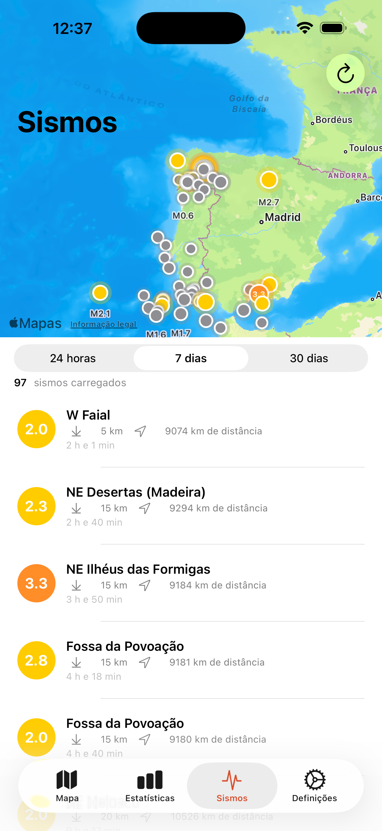
Real-Time Earthquakes
Official IPMA earthquake data for mainland Portugal, Madeira and the Azores, complemented by worldwide USGS data. Map and history for 24 h, 7 or 30 days, with push alerts above the magnitude you choose.
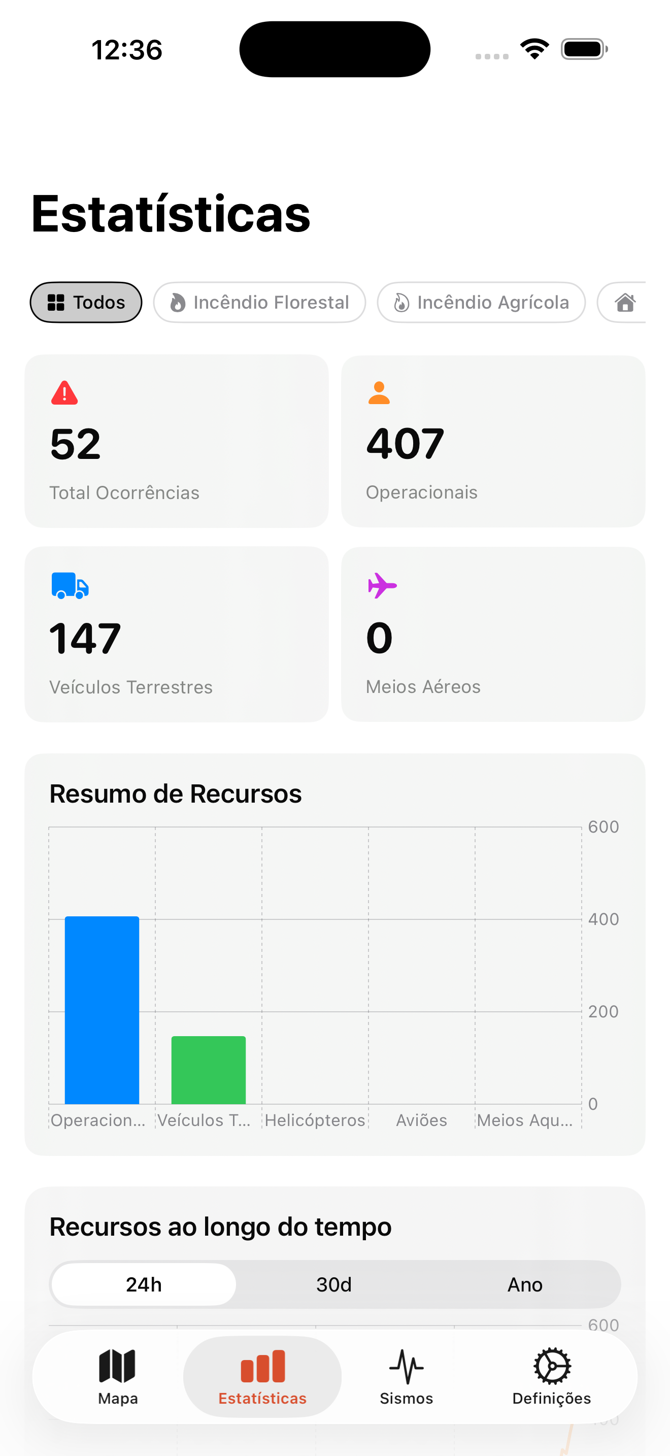
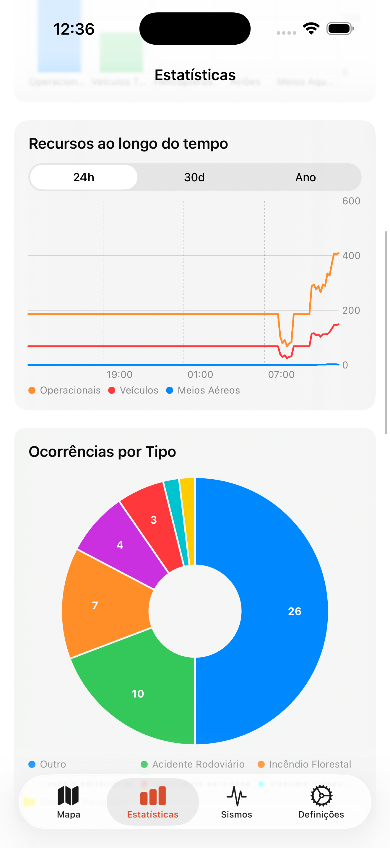
Live Statistics
See active incidents, firefighters, vehicles and aerial assets deployed across the country, with charts of how the numbers evolve.
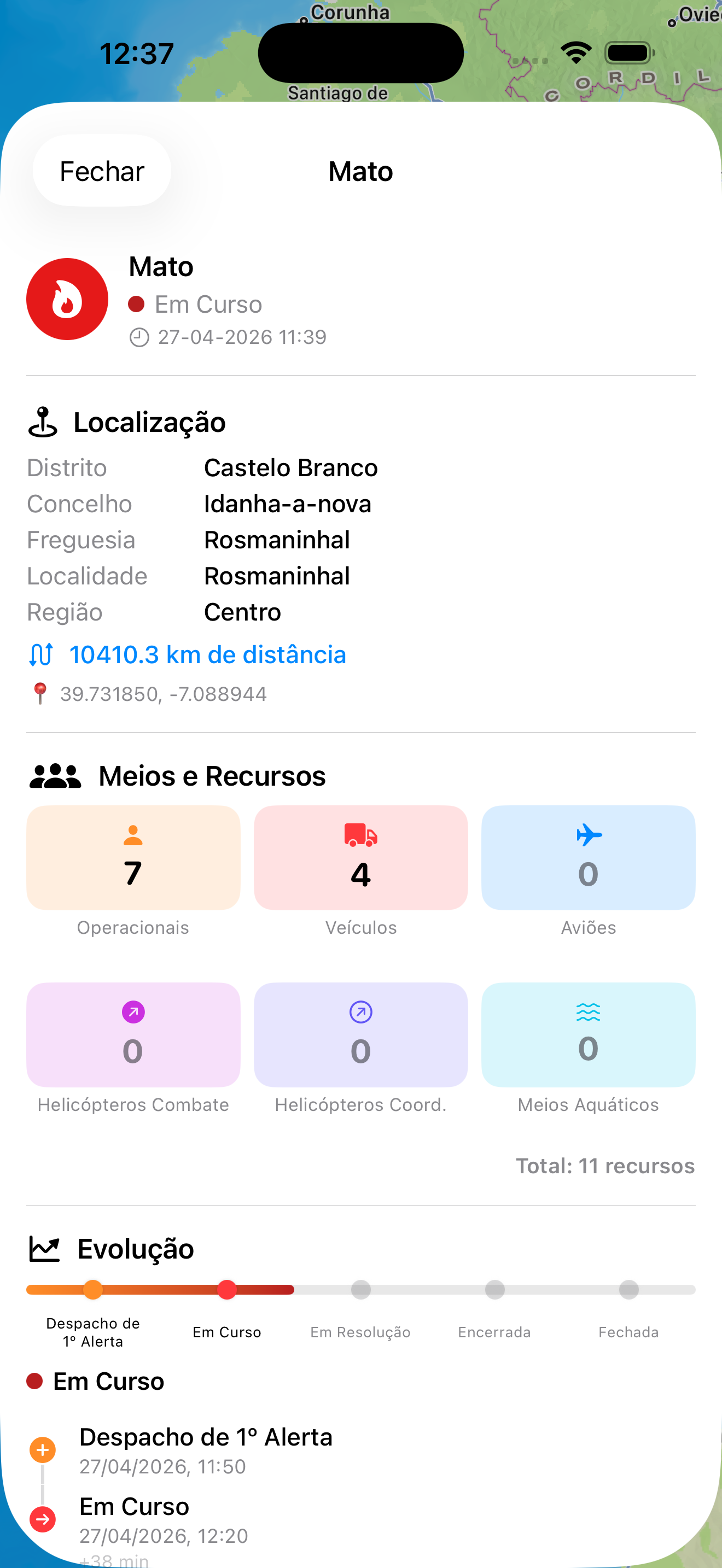
Deployed Resources
Detailed information on firefighters, vehicles and aerial assets at every incident, and how they evolved since dispatch.
Location-Aware
Centre the map on your current position and see the incidents closest to you. Your location never leaves the device without your consent.
3 Languages
Available in Portuguese, English and German.
Data Sources
ANEPC / ProCiv
Official data from the Portuguese National Civil Protection Authority on incidents across the country.
IPMA — Portuguese Institute for Sea and Atmosphere
Official seismic data for mainland Portugal, Madeira and the Azores, updated regularly.
USGS — United States Geological Survey
Worldwide earthquake coverage to complement IPMA data, enabling alerts for earthquakes anywhere on the globe.
Community Reports
Everyday events reported by authenticated users and moderated by operators. Users are identified by their reputation level to preserve trust.
Requirements
- iOS 18.0 or later
- iPadOS 18.0 or later
- macOS 15.0 or later
- Android 8.0 or later
Support
Contact
Questions or feedback? Email walter.tengler@gmail.com
FAQ
Alerta uses official data from the Portuguese civil protection authority. Data is updated regularly. The app is intended for informational purposes only.